


夜歸地圖 Midnight Map app for iPhone and iPad
Developer: RiChi Technology Inc.
First release : 01 May 2014
App size: 11.14 Mb
1.4版重大更新
**新增台中市夜間開放運動學校**
----------------------------------------
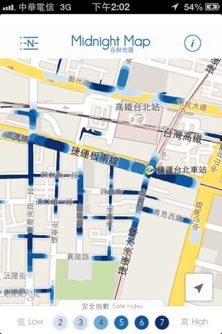
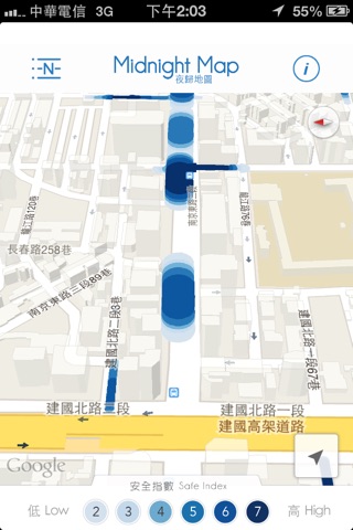
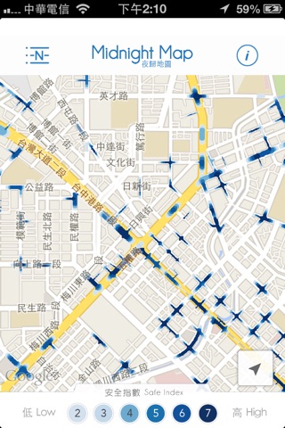
夜歸地圖,主要呈現臺灣夜晚街道之明亮程度,其目的在於提供不熟悉環境之使用者夜間安全路徑,避開行走昏暗街道,也能確保自身安全。我們納入約20,000筆的POI資料,其中包括24小時營業的便利商店、加油站、飯店、警察局、KTV與速食店等,藉由POI位置判
斷道路是否安全。另一方面,為了模擬商店於夜間不同距離其光線明亮程度差異,引入POI強度圖概念,即POI越密集的街道,光線越充足,相對地安全性也較高。
The purpose of Midnight Map is to provide the safety sections of the roads for users who are not familiar with the way to destination or return home late. We acquired the safety roads at night by choosing nearly 20,000 POIs which are 24-hour opening in Taiwan, including convenient stores, gas stations, hotels, police office, KTV, fast-food restaurants and so on. In order to simulate the light stretching of a store, we used POI kernel density to display the light gradient which also means the level of safety.